Santorini is a good hiking island, as long as you understand what kind of hiking it offers: cliff-top walking between villages on the caldera rim, plus a few steep climbs to archaeological sites and a volcano. The classic route is the Fira to Oia caldera trail (10.5 km, 3 to 4 hours), and the island also has an official numbered footpath network signposted by the Greek tourism authority. Heat is the main hazard here. From June to September you should be walking by 7am, because there is no shade and no water on the second half of the caldera trail. Below are the nine hikes worth your time, with distances, difficulty, entrance fees and how to get back.

Affiliate disclosure: some links on this page are affiliate links. If you book through them we may earn a small commission at no extra cost to you. It never changes which trails we recommend. See our affiliate disclosure.
Is Santorini good for hiking?
Yes, but for a specific kind of walking. Santorini has no forest, no rivers and no alpine trails. What it has is a 300-metre-high volcanic rim you can walk along for hours, villages spaced closely enough to break the walk into stages, and two archaeological climbs that most visitors never attempt. Almost every trail is exposed, dry and rocky.
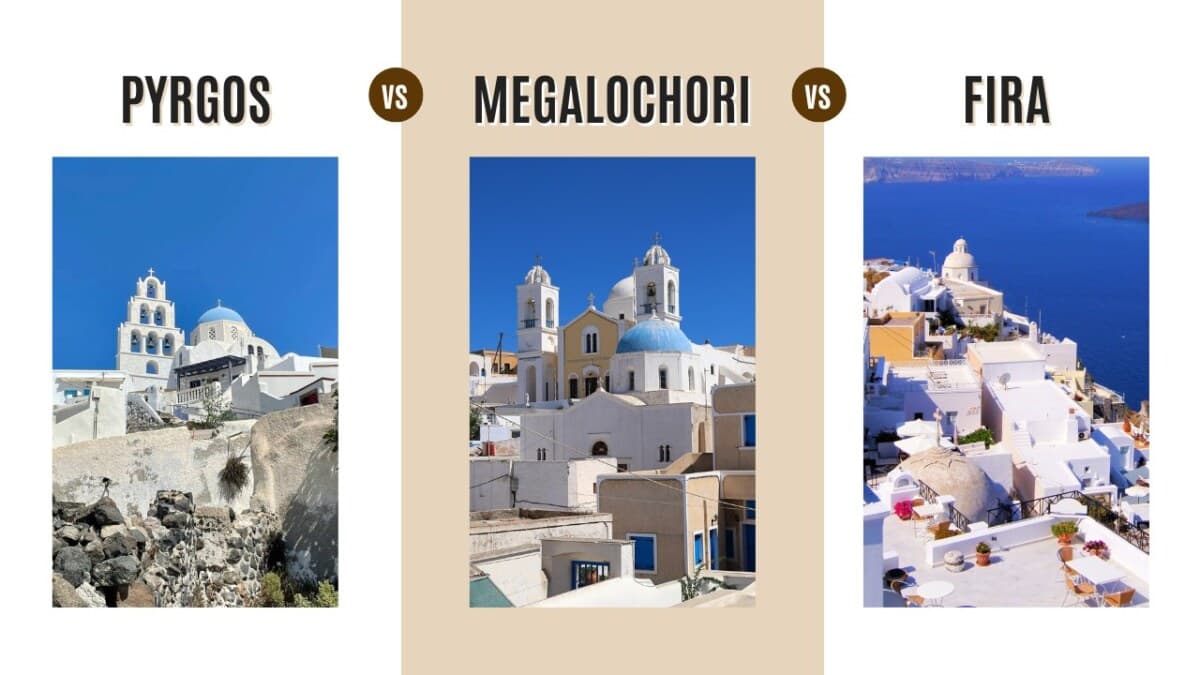
The island also has a waymarked footpath network numbered by the Greek Ministry of Tourism. Path One links Pyrgos, the Profitis Ilias monastery and Ancient Thera; Paths Two, Four and Six branch off it around Pyrgos and Megalochori. Most guides ignore these entirely and only cover the caldera rim, which is why the inland routes stay quiet even in August.
Santorini hikes at a glance
Every trail below, with the numbers you actually need before you set out. Times are one-way walking times for an average hiker, not including stops.
| Hike | Distance | Time | Difficulty | Surface | Shade | Getting back |
|---|---|---|---|---|---|---|
| Fira to Oia (caldera trail) | 10.5 km | 3–4 h | Moderate | Paved streets, cobbles, loose gravel | None after Imerovigli | KTEL bus, €2.20 |
| Fira to Imerovigli and Skaros Rock | 8.5 km | ~2 h | Easy to Imerovigli, tricky on Skaros | Paved, then narrow steps and rock | Some, in the villages | Walk or bus back to Fira |
| Kamari to Ancient Thera | 7.5 km | ~2.5 h | Hard, continuous uphill | Narrow shared road, then ancient paved path | None | Same way down, or taxi |
| Perissa to Ancient Thera | ~11 km | 3–4 h | Hard, rough underfoot | Rocky unmade path | None | Same way, or descend to Kamari |
| Nea Kameni volcano | 2.5 km | ~1 h | Easy but fully exposed | Loose volcanic gravel | None at all | Your boat, on a fixed schedule |
| Oia to Ammoudi Bay | 1.5 km | 20 min down, ~30 up | Easy down, steep back up | Wide stone steps | Very little | Walk up, or taxi from Ammoudi |
| Fira to the Old Port | 2 km | ~45 min | Hard going up | 588 cobbled steps | None | Cable car, €10 one way |
| Red Beach path | 1.5 km | ~20 min | Officially signposted as closed | Loose, unstable cliff scramble | None | Boat from Akrotiri, €5–8 |
| Pyrgos to Profitis Ilias | ~2.4 km | 1–1.5 h | Moderate, steady climb | Cobbled path, then road | None | Same way down to Pyrgos |
Best Things to Do in Santorini
Best Beaches in Santorini
Best Family Hotels in Santorini
Best Hotels in Oia
Best Wineries in Santorini
When is the best time to hike in Santorini?
April to May and October are the best months. In high summer the caldera trail is walkable only in the early morning, because daytime temperatures regularly pass 30 °C (86 °F) and there is no shade at all on the long stretch between Imerovigli and Oia.
| Season | What hiking is like | Start walking by |
|---|---|---|
| November to March | Coolest and quietest. Strong wind and occasional rain on the rim. Archaeological sites run reduced winter access. | Any time of day |
| April to May | The best window. Mild, green, and the trails are close to empty. | Before 10:00 |
| June to September | Regularly above 30 °C (86 °F), no shade, and the busiest paths. The heat is what makes these months hard. | 07:00 |
| October | Warm sea, cooler air, far fewer people on the caldera path. | Before 10:00 |
What to bring on a Santorini hike
- Carry at least 1.5 to 2 litres of water per person. There are no fountains or kiosks on the second half of the Fira to Oia trail, and none at all on the Ancient Thera climbs. A tip from a Greek: freeze a bottle overnight and carry it as solid ice, so you have cold water for hours. My mother did this for our beach trips when I was a kid.
- Wear closed-toe shoes with grip. You do not need heavy boots for the caldera paths, but you do need proper walking or running shoes. The gravel sections and the rock around Skaros are slippery. No flip-flops.
- Put on a hat and sunscreen over every exposed patch of skin, the back of your neck and arms included. On these trails the sun does more damage than the distance.
- Bring cash in coins and small notes. Nea Kameni charges a €5 park fee on landing and takes no cards.
- If you only have time for one short walk, do Fira to Imerovigli. It is quick, mostly flat and gives you the caldera view without the commitment. See my video below.
The nine best hikes in Santorini
I recently walked the Fira to Imerovigli section and filmed it in real time, so you can see exactly what the surface and the gradient look like before you commit:
Each hike below includes its AllTrails map so you can follow the exact route offline.
Fira to Oia, the classic caldera trail (10.5 km ~ 3.5 hrs)

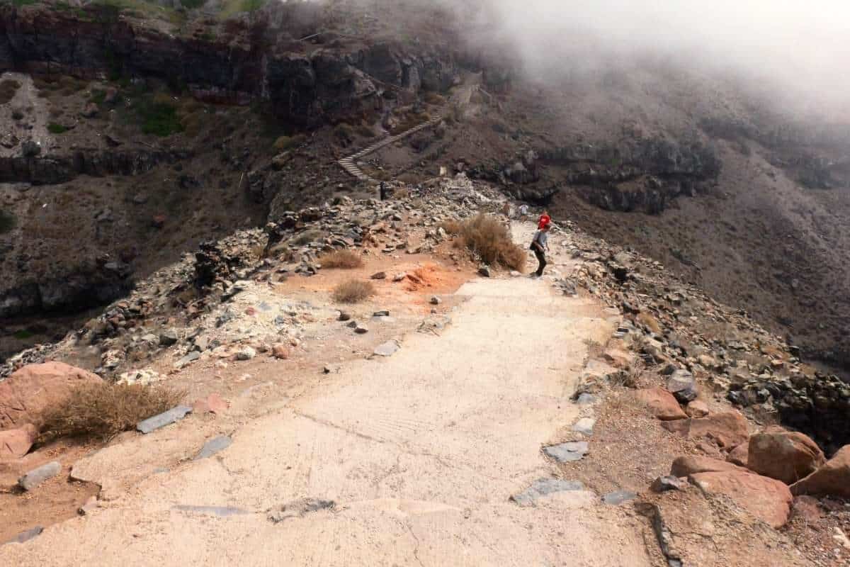
The caldera trail runs 10.5 km (6.5 miles) along the rim from Fira to Oia, climbs roughly 300 metres in total, and takes most people 3 to 4 hours. It is open all year. The surface changes constantly: paved pedestrian streets through Fira, Firostefani and Imerovigli, then cobbles, then loose gravel on the open hillside. Some sections have loose rock and can be slippery. In winter, and sometimes in summer, you will meet strong wind on the exposed stretches, but nothing alarming.
The important practical point: the first third has cafes and shops in the three villages, and the last two-thirds has nothing. No kiosk, no fountain, no shade. Carry your water from Fira and eat in Oia at the end, or in Fira if you walk the route in reverse. This is a busy path at any time of year. If you want solitude, walk up to Ancient Thera from Kamari instead.
Fira to Imerovigli and Skaros Rock, the best short hike (8.5 km ~ 2 hrs)
This is the hike to do if you only have a couple of hours. As far as Imerovigli it is really a village walk through Fira and Firostefani, with a few flights of steps and no difficulty. The Skaros Rock extension is a different matter: narrow steps and rocky, slippery paths down onto the headland. It is worth it, because the view back at the rim from Skaros is completely unlike the view from the path above.
Skaros is the remains of a Venetian castle, the island’s medieval stronghold, abandoned after earthquakes destroyed it. Little of the structure survives, so go for the headland and the view rather than the ruins.
Kamari to Ancient Thera, the best views on the island (7.5 km ~ 2.5 hrs)

This is a continuous uphill climb from Kamari to the ancient city on the Mesa Vouno ridge. Most of it shares a narrow road with cars, so walk facing the traffic; the final section is an old paved footpath. Entry to the archaeological site costs €10, and it is open daily except Wednesdays from 08:30 to 15:30. Time the walk so you arrive well before closing, and do not plan this hike for a Wednesday.
This is my favourite trail on Santorini. You get views the caldera crowd never sees, and you finish at an archaeological site founded by Dorian settlers in the 9th century BC. There is no water and no shade on the way up, so carry more than you think you need.
Perissa to Ancient Thera, the hard way up (11 km ~ 3-4 hrs)

This trail starts at the far end of Perissa beach, at the foot of the hill, and climbs to Ancient Thera on rough, unmade ground. Kamari and Perissa are really one long black beach divided by the Mesa Vouno ridge, and you can climb it from either side. Allow 3 to 4 hours if you are walking up and back down; the Kamari approach is the easier of the two.
Carry water and food, because there is nothing along the route. Same site rules apply: €10 entry, closed Wednesdays, last entry well before 15:30.
Nea Kameni, walking on the active volcano (2.5 km ~ 1 hr)

You cannot reach this one independently. Nea Kameni is an uninhabited volcanic islet in the middle of the caldera, and the only way there is a boat tour from the Old Port of Fira or from Athinios. The volcanic park charges a €5 entrance fee on landing, in cash, and it is almost never included in the boat ticket. There are no card machines and no facilities of any kind on the island, so bring coins and small notes.
The path itself is a marked gravel loop of about 2.5 km up to the main crater, roughly an hour at the pace the groups actually move. Honestly, apart from the fact that you are walking across hardened lava on an active volcano, the path is not thrilling in itself. What makes it worth doing is the caldera view from the top, with Fira and Oia strung along the cliff opposite, and the hot springs stop on the way back. Combining it with a boat cruise in Santorini is one of the better days you can have here. Stay on the marked path: the ground is thin and the fumaroles are hot.
Oia to Ammoudi Bay, down to the fish tavernas (1.5 km ~ 20 mins)

Ammoudi Bay is the small harbour at the bottom of the Oia cliff, known for its fish tavernas at the water’s edge. You reach it either by these wide stone steps or by car, and I would not drive: parking down there is very limited and it jams badly at dinner time.
Going down takes about 20 minutes and is easy. Coming back up is the part people underestimate, especially after a long lunch in the heat. Allow half an hour, take it slowly, and if you have booked a sunset table, walk down early rather than rushing. There are usually taxis at the bay if you would rather not climb back.
Fira to the Old Port, the 588 steps (2 km ~ 45 mins)

The Karavolades stairs zigzag 588 cobbled steps between Fira and the Old Port. It is the same idea as the Oia to Ammoudi path but much harder. If you arrive on a cruise ship your realistic options are these steps, or the cable car, where the queue in peak season can run to an hour.
The cable car takes about three minutes. According to the operator’s own price list, a one-way ticket is €10 for general admission and €5 reduced, which covers children aged 6 to 12, large families, people with disabilities, tour guides, group leaders and ship crew. Children under 6 travel free. Tickets are one-way and non-refundable.
Please do not ride the donkeys. Beyond the animal welfare problem, the path is covered in manure and you will be sharing narrow steps with animals coming the other way. The cobbles get slippery, particularly on the way down, so take the descent slowly. The views are good, but this path gets crowded from June to September.
Red Beach: why the cliff path is signposted as closed (1.5 km ~ 20 minutes)

I am listing this one so you can make an informed decision, not as a recommendation. The footpath down to Red Beach is signposted by the local authorities as closed, with notices warning of falling rocks and serious risk of injury. The red cliffs are unstable volcanic rock and there have been repeated major rockfalls, including one in February 2025 during the earthquake swarm that shut the beach entirely, and another in December 2025. People have been injured here.
The safe way to see it is by boat. Small boats run from Akrotiri’s harbour to Red Beach in about 10 minutes for roughly €5 to €8 per person, and some continue to White Beach, which has no land access at all. You get the same view of the cliff face, from the angle that actually photographs well, without standing underneath it. Catamaran and volcano cruises usually pass it too.
If you go by land anyway, KTEL buses run from Fira to Akrotiri in about 20 minutes and the parking area is a short walk from the bus stop. Check the signs at the top before you start, ask at the Akrotiri site or the car park about current conditions, and if the path is barriered off, do not step around it. Conditions change after rain, wind and seismic activity.
Pyrgos to Profitis Ilias, the highest point in Santorini (2.4 km ~ 1-1.5 hrs)
This is the hike almost no guide mentions, and the one to do if you want the caldera trail’s views without the caldera trail’s crowds. It starts in Pyrgos Kallistis, the highest village on the island, and climbs a cobbled path and then a road to the Profitis Ilias monastery at 567 metres, the summit of Santorini. Allow an hour to an hour and a half up, with about 240 metres of climbing.
Two things make it worth the effort. First, this is the only point on Santorini from which you can see the entire island at once, from Oia in the north to the Akrotiri peninsula in the south, with Ios and the smaller Cyclades on the horizon. Second, the mountain is limestone rather than volcanic rock, so it shows you what Santorini looked like before the Minoan eruption blew the rest of it apart. The monastery itself dates from 1711.
The route is part of Path One in the island’s numbered footpath network, which continues from Profitis Ilias along the ridge to Ancient Thera. If you have a full day and good legs, walking Pyrgos to Profitis Ilias to Ancient Thera and down to Kamari is the most complete hike on Santorini. Take the KTEL bus to Pyrgos to start, and note there is no water on the mountain.
How do you get back after the Fira to Oia hike?
You do not walk back. Take the KTEL bus from the main bus terminal in Oia to Fira: the ride is about 25 minutes and the 2026 fare is €2.20, per the operator’s price list updated 19 May 2026. Buses run frequently through the day, but the queue immediately after sunset is long, so either leave before the crowd or wait it out with a drink. A pre-booked taxi is the alternative and costs considerably more.
The same applies to the Ancient Thera climbs and Pyrgos: every trailhead on this list is on a bus route. Full timetables and fares for every line are in our Santorini bus schedule guide, including the night buses and the 25 percent surcharge that applies between 00:30 and 05:00.
Which Santorini hike should you choose?
If you do one hike, walk Fira to Oia, starting early. If you have two hours, walk Fira to Imerovigli and add Skaros Rock. If you want the best view on the island and no crowds, climb to Ancient Thera from Kamari or to Profitis Ilias from Pyrgos. If you are on a cruise ship for the day, the Old Port steps and a caldera stroll are all you will have time for.
None of these trails is technically difficult. The thing that actually catches people out is the combination of heat, sun and no water, so plan around that first and the rest takes care of itself. Wear proper shoes, start early, carry more water than feels necessary, and check the archaeological site hours before you climb to one.
FAQs
How Long Is The Hike From Fira To Oia?
The caldera trail from Fira to Oia is 10.5 kilometres (6.5 miles) and takes the average hiker 3 to 4 hours, with roughly 300 metres of total climbing. The path is a mix of paved pedestrian streets, cobblestones and loose gravel, and there is a significant uphill section just after Imerovigli. Start by 7:00 AM between June and September, because there is no shade on the second half of the trail.
Do I Need Hiking Boots For Santorini?
You do not need heavy-duty hiking boots for the standard caldera paths. You do need sturdy, closed-toe walking or running shoes. The trails, especially the descent to Skaros Rock and the gravel sections between Imerovigli and Oia, are slippery because of loose volcanic rock. Never attempt these trails in flip-flops or sandals.
Is Santorini Good For Hiking?
Yes, for cliff-top and village walking rather than wilderness hiking. Santorini has no forest and no rivers, but it does have a caldera rim you can walk for 10.5 kilometres, two archaeological climbs above Kamari and Perissa, a volcano crater path, and a waymarked footpath network numbered by the Greek Ministry of Tourism. Almost every trail is exposed, dry and rocky, so the heat is the thing to plan around.
What Is The Best Time Of Year To Hike In Santorini?
April to May and October are the best months, with mild temperatures and far fewer people on the paths. From June to September temperatures regularly pass 30°C (86°F) with no shade on the caldera trail, so walk between 7:00 and 11:00 AM or not at all. November to March is cool and quiet but windier, and the archaeological sites run reduced winter access.
Are The Hiking Trails In Santorini Safe?
The main trails are safe if you respect the conditions. Heat is the biggest danger. Summer temperatures frequently exceed 30°C (86°F) and you should carry at least 1.5 litres of water per person. The exception is the cliff path down to Red Beach, which local authorities have signposted as closed because of falling rocks. Major rockfalls happened there in February 2025 and December 2025. Reach Red Beach by boat from Akrotiri instead.
Can I Hike The Volcano In Santorini?
You cannot hike it independently. Nea Kameni is an uninhabited volcanic island reached only by booking a boat tour from the Old Port of Fira or from Athinios. Once you land, the marked crater loop is about 2.5 kilometres and takes around an hour at group pace. The volcanic park charges a 5 euro entrance fee on arrival, it is almost never included in the boat ticket, and there are no card machines on the island, so bring cash.
How Do I Get Back From Oia After The Hike?
If you hike from Fira to Oia you do not need to walk back. Take the KTEL bus from the main Oia bus terminal to Fira. The ride takes about 25 minutes and the 2026 fare is 2.20 euro, per the operator price list updated 19 May 2026. Buses run frequently, but expect long queues immediately after sunset. A pre-booked taxi is the alternative and costs considerably more.
Sources and what changed in this update
Updated 5 August 2026. This update corrected the Ancient Thera entrance fee, which had been listed at 6 euro and is now €10, and added the site’s opening hours and Wednesday closure. It rewrote the Red Beach section after checking the current rockfall warnings, because the path is officially signposted as closed and the previous version recommended it without that context. It corrected the Oia to Fira bus fare from €1.60 to the current €2.20, added the verified cable car fares, resolved a contradiction in the stated walking time for the Perissa climb, and added a ninth hike, Pyrgos to Profitis Ilias, along with new sections on hiking conditions, seasons and getting back to your base.
- Ancient Thera fee and opening hours: Santorini.net, museum and archaeological site hours and fees
- Cable car fares: Santorini Cable Car official price list
- Numbered footpath network: Exploring Greece, Path One: Pyrgos to Prophet Elias to Ancient Thera
- Red Beach closure and rockfalls: To Vima, Red Beach closed after rockfall
- Bus fares: KTEL Santorini price list updated 19 May 2026, as recorded in our Santorini bus schedule guide